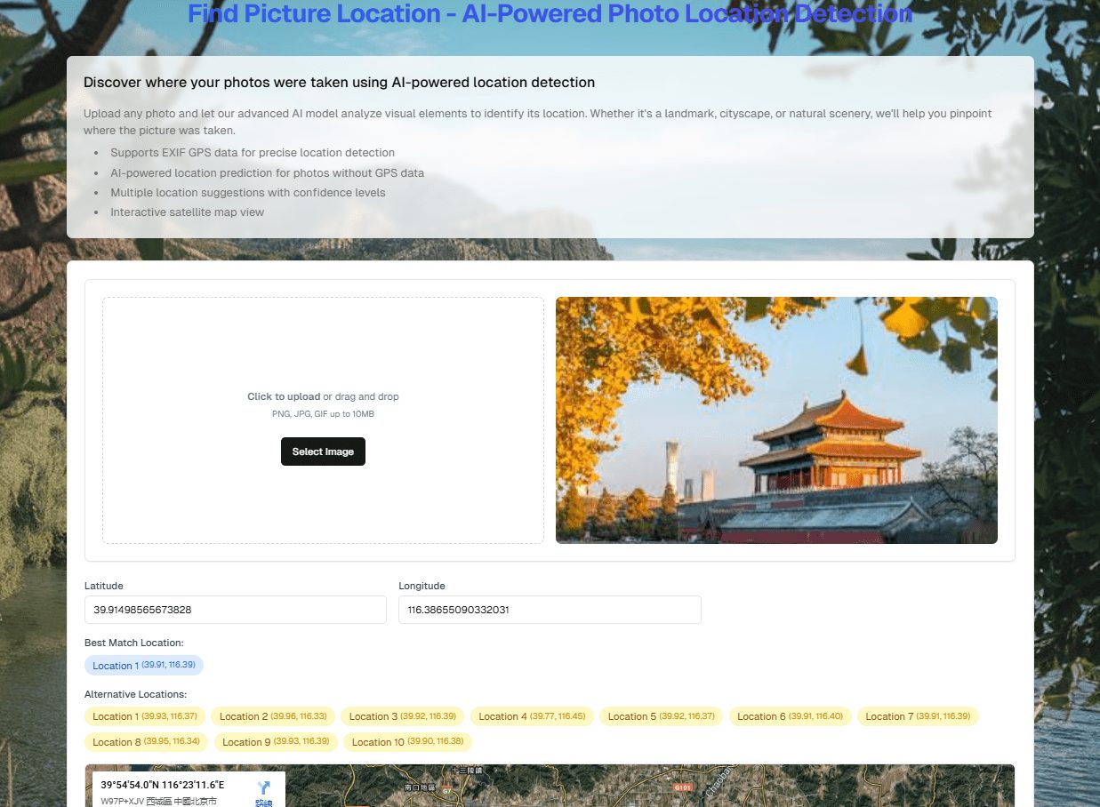
FindPicLocation: Use AI technology to locate the location where the photo was taken, and quickly get the GPS location of the photo.
General Introduction
FindPicLocation is a website that uses artificial intelligence technology to help users locate where their photos were taken. Users simply upload a photo, and the system automatically analyzes the EXIF data in the photo, extracts the GPS coordinates, and displays the exact location on a map. The site aims to provide individuals and businesses with accurate and reliable photo geolocation solutions for a wide range of scenarios, including exploration, research and decision-making.
Similar tools:GeoSpy AI: An Intelligent Prediction Platform for Geolocation of Images

Function List
- Photo Upload: Users can upload any photo and the system will automatically analyze its EXIF data.
- GPS Coordinate Extraction: Extract GPS information such as latitude and longitude from photos.
- Map display: Shows the exact location where the photo was taken on a map.
- EXIF Data Viewing: View detailed EXIF information about the photo, including the time it was taken, camera model, aperture, shutter speed, and more.
- Privacy: Ensure that photos and data uploaded by users are not compromised.
Using Help
How to use FindPicLocation
- Upload photos: Click the "Upload Photo" button on the home page to select the photo file you want to locate. Supported file formats include .jpg, .jpeg, .png and so on.
- Analyzing photos: After the upload is completed, the system will automatically analyze the EXIF data in the photos and extract the GPS coordinate information.
- View Results: Once the analysis is complete, the system displays the exact location where the photo was taken on a map and provides detailed EXIF data viewing options.
Detailed function operation flow
- Photo Upload::
- Click the "Upload Photo" button to select a locally stored photo file.
- Once the photo is uploaded, the system will automatically start analyzing it.
- GPS Coordinate Extraction::
- The system extracts latitude and longitude information from the EXIF data of the photo.
- If the photo does not contain GPS data, the system will prompt the user.
- Map display::
- After extracting the GPS coordinates, the system will mark the location where the photo was taken on the map.
- Users can zoom in and out of the map to view more detailed location information.
- EXIF Data Viewing::
- Click the "View EXIF Data" button to view detailed information about the photo, including the time it was taken, camera model, aperture, and shutter speed.
- This information helps the user to better understand the environment and parameters under which the photo was taken.
- Privacy::
- FindPicLocation focuses on user privacy and all uploaded photos and data will not be disclosed or used for other purposes.
- Users can use the service without worrying about privacy.
Frequently Asked Questions
- What if the photo has no GPS data? If the photo does not contain GPS data, the system will not be able to locate the location where the photo was taken. It is recommended that users use a device with GPS capability to take photos.
- Is there a limit to the number of photos I can upload? There is no definitive limit on the number of photos, but it is recommended that users upload no more than 10 photos at a time to ensure that the system can process them quickly.
- How do I ensure photo privacy? FindPicLocation is committed to not disclosing any of the photos and data uploaded by users, and all processing takes place in a secure environment.
With the above steps and detailed introduction, users can easily get started with FindPicLocation to quickly locate the place where the photo was taken and get detailed geolocation information.
© Copyright notes
Article copyright AI Sharing Circle All, please do not reproduce without permission.
Related posts

No comments...


