GeoSpy AI: An Intelligent Prediction Platform for Geolocation of Images
General Introduction
GeoSpy AI is an online tool that uses artificial intelligence technology to analyze the geographic location of photos. Users simply upload a photo and the system analyzes various details and clues in the photo to deduce the possible location.GeoSpy AI is for law enforcement agencies, government departments, journalists and investigators to help them extract valuable information from photos.
Function List
- Photo upload: Users can upload photos for geolocation analysis.
- Geolocation speculation: analyze the details of the photo through AI algorithms to speculate the location of the shot.
- Batch Processing: Supports batch uploading and processing of a large number of photos.
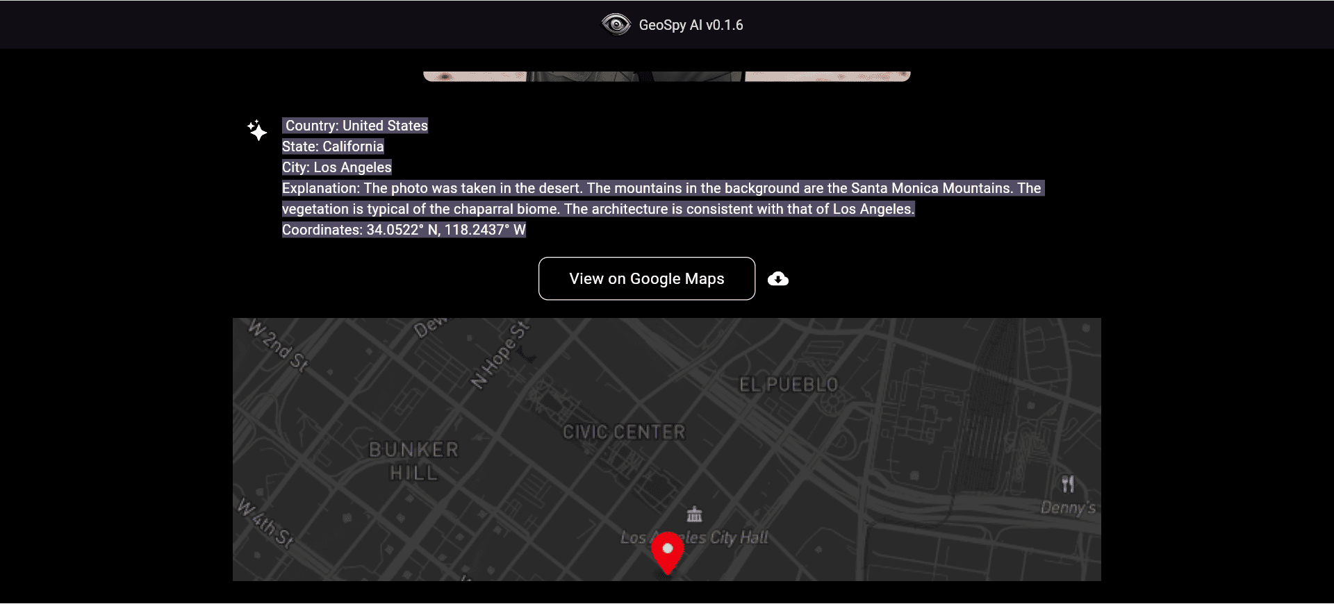
- Data Analysis: Provides detailed geolocation analysis reports with coordinates and descriptions.
Using Help
workflow
- Access to the website: Open your browser and visit GeoSpy AI.
- Upload photos: Click the "Upload Photo" button and select the photo file to be analyzed.
- input: Follow the prompts to enter a possible location (country/city) where the photo was taken.
- Start analysis: Click the "Start Analyzing" button and the system will automatically analyze the photo and generate a geolocation report.
- View Results: After a few seconds, the system displays the estimated location where the photo was taken, including coordinates and a brief description.
Functional operation details
- Photo Upload: Supports multiple formats of photo files, users can upload photos by dragging and dropping or clicking buttons.
- Geographic speculation: GeoSpy AI uses advanced AI algorithms to analyze the details of buildings, natural landscapes, and other features in a photo to speculate on possible locations.
- batch file: For users who need to process a large number of photos, such as law enforcement agencies and investigators. Users can upload multiple photo files at once and the system will analyze them one by one.
- data analysis: The analysis report includes the estimated coordinates of where the photo was taken, a brief description, and relevant geographic information to help users better understand the context of the photo.
Usage Scenarios
- Law enforcement investigations: Helps law enforcement officers quickly determine where photos were taken and aids in case investigations.
- story: Journalists can use GeoSpy AI to determine where news photos were taken and improve the accuracy of their stories.
- personal use: Ordinary users can also use GeoSpy AI for personal needs, such as geolocation logging of travel photos.
GeoSpy AI provides powerful image geolocation analysis, allowing users to easily upload photos and get detailed geolocation reports for a wide range of professional and personal scenarios.
© Copyright notes
Article copyright AI Sharing Circle All, please do not reproduce without permission.
Related articles

No comments...

